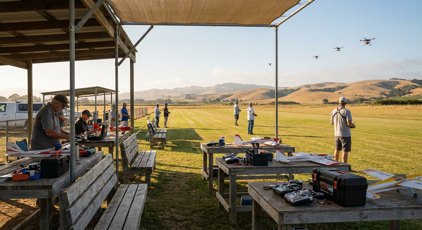
In February 2026, the federal docket on beyond-visual-line-of-sight (BVLOS) rulemaking wrapped up its reopened comment window on right-of-way and electronic conspicuity, while the final FAA Part 108 rule package sat under review at the Office of Information and Regulatory Affairs. For delivery operators and test hubs running thousands of automated flights between regional airports, medical centers, and logistics depots, this marks the start of routine commercial routing. For weekend modelers packing a 60-inch balsa stick or a foam EDF jet into the back of an estate car on Sunday morning, it means something much closer to home: commercial flight corridors are starting to overlap the airspace right next to suburban flying patches.
If your club field sits within ten miles of a regional airport, an industrial distribution hub, or a state-backed unmanned test corridor like those in central New York or North Dakota, the sky beyond your tree line is changing. Commercial delivery rigs weighing anywhere from twenty to over a thousand pounds are testing automated point-to-point routes below 400 feet. If your club committee waits until a four-rotor delivery drone cuts across your dead-stick descent path, you are already on the back foot. Protecting your field does not take expensive legal counsel, but it does take knowing where these corridors run, how commercial operators plan their routes, and how to set local club rules so your members can keep flying without incident.
The Squeeze on the Edge of Town
Most traditional model clubs did not pick their land by accident. Decades ago, committees leased parcels from local farmers, landfill authorities, or municipal water boards because the land was cheap, flat, and miles away from residential developments. Over thirty or forty years, suburban sprawl caught up with the roads, but the airspace overhead stayed quiet.
Commercial drone logistics operations look for almost the exact same geographical features. When delivery companies map out early automated routes, they avoid dense downtown high-rises and tightly controlled Class B airspace. Instead, they pick transit ribbons that follow utility easements, railway lines, river valleys, and agricultural buffers on the outskirts of tier-two and tier-three cities. That places their planned navigation paths right over the farmland, flood basins, and sod farms where RC clubs have operated for generations.
Under current Part 107 waivers and the upcoming Part 108 framework, commercial delivery aircraft run on automated flight plans managed by onboard autonomy and ground-based fleet software. These aircraft rely on detect-and-avoid sensors, ADS-B receivers, and pre-programmed geofenced corridors. A giant delivery drone flying at 300 feet does not have a human pilot scanning the horizon with binoculars. It follows a waypoint line, trusting that the airspace is either clear or that non-participating traffic will show up on its sensors. If your club field sits right beneath or alongside that corridor, you need to know about it before your members throttle up.
How Commercial Corridors Are Mapped
Commercial operators do not just wander through random skies. They fly narrow, highly predictable survey and transit lanes approved through regulatory waivers or specific testing authorizations. Understanding how these lanes are built makes it much easier to see whether your field is in the crosshairs.
| Corridor Type | Typical Flight Ceiling | Primary Navigation Method | Hazard to Club Patterns | Tracking Source |
|---|---|---|---|---|
| Medical & Grocery Delivery | 150 to 300 ft AGL | GPS waypoints along utility ribbons | Direct cross-traffic on pattern approach | Local city council permits, operator flight maps |
| Infrastructure Survey (Rail/Power) | 100 to 250 ft AGL | Linear infrastructure tracking | Periodic low-level sweeps along property boundaries | State DOT notices, utility work permits |
| Regional Cargo Transit | 300 to 400 ft AGL | Fixed point-to-point grid routes | Encroachment on high-altitude glider and jet boxes | FAA test site announcements, Part 108 corridor filings |
| State Test Hubs (e.g., NUAIR) | Surface to 400+ ft AGL | Ground-based radar and optical arrays | Active continuous corridor testing across multi-mile paths | Regional UAS test site bulletins, local NOTAMs |
Commercial operators want to avoid active club fields just as much as you want to avoid them. A mid-air collision with a six-pound foam warbird ruins their test program, triggers an immediate federal investigation, and grounds their entire fleet. When an operator designs a corridor, their route planners use public GIS databases, FAA airspace maps, and recognized community fields to draw buffer zones. If your field is not clearly visible on their planning layers, their computer simply routes the transit corridor across your runway.
Step One: Audit Your Surrounding Airspace
Do not guess where delivery routes are popping up. Your club committee should run a basic airspace audit once every six months to see what has changed around your boundary markers.
First, check your FAA Recognized Identification Area (FRIA) status. If your field obtained FRIA status through an established community organization, your geographic boundaries are recorded on the FAA's public airspace database. Commercial flight planners download these database layers when setting up their geofencing. Pull up your club coordinates on an interactive airspace map like the FAA's UAS Data Delivery System or third-party flight planning tools used by commercial remote pilots. Check if your FRIA boundary box accurately covers your actual flying area, including the extended pattern turns past the ends of the runway.
Second, check for state or regional test corridors. In regions like central New York, where organizations like NUAIR have logged thousands of corridor flights, testing zones cover multi-county transit paths between municipal airports. State transport departments and economic development boards publish the geographical boundaries of these test beds. If your field sits inside one of these broad test envelopes, commercial flights are already happening in your county.
Third, monitor local airport notices and city council filings. Commercial delivery providers must file route applications, landing hub permits, and launch site approvals with local municipal boards before they put a single propeller in the air. If a grocery chain or logistics carrier is building a hub three miles east of your runway, their transit lines will almost certainly run across the rural edges of your township.
Step Two: Contact the Route Operators Directly
If you find that an active delivery route or testing corridor passes near your field, pick up the phone. Commercial drone companies are not faceless government agencies. They employ flight operations managers, chief safety officers, and local site leads whose primary job is avoiding airspace incidents.
When you reach out, skip the emotional complaints about hobby rights and approach them like another local airspace user. Give them exact, practical details:
- Precise coordinates for your runway centerline, pit area, and outer flight boundary box.
- Standard flying hours, especially peak traffic times like Saturday and Sunday mornings from 8:00 AM to 1:00 PM.
- Typical operating altitudes, noting that standard visual flying stays below 400 feet, but thermal gliders or large-scale models might hold waivered altitudes if your field has one.
- Contact numbers for the club safety officer and field manager.
Ask the flight operations team to add your field boundary and a 500-yard safety buffer to their navigation software as an exclusion zone. In almost every case, a commercial delivery operator will gladly bend their route 400 yards to the north to clear a known RC field. Bending a route adds three seconds to their transit time, whereas flying over an active RC pattern is an unacceptable liability risk for their operating certificate.
If the operator is running tests under a regional test site authority, ask to be added to their stakeholder mailing list. When test managers plan wide-area corridor trials, they send advance notices to surrounding airports, agricultural sprayers, and registered model fields.
Adjusting Your Club Pattern and Flight Box
Even with good communication, corridors near your boundary mean your club needs clear, practical rules for what happens in the air. You cannot control what flies through the corridor half a mile away, but you have absolute control over your own pattern discipline.
Mark the Physical Flight Boundaries
Many clubs have an unspoken agreement about where people fly. Old-timers know not to fly past the red barn or beyond the tree line at the east end of the grass. When commercial traffic operates nearby, vague landmarks are not enough. Put up a clear flight box map on the main pit board. Paint corner posts or install high-visibility boundary flags at the edges of the club property. If members know that crossing the drainage ditch puts them outside the club's protected envelope, they will keep their turns tighter.
Set Pattern Altitudes and Downwind Legs
If commercial delivery aircraft are routing across an easement just north of your field at 250 to 300 feet, adjust your local pattern rules to keep traffic separated:
- Keep standard sport patterns, park flyers, and 3D aerobatics below 200 feet AGL during peak club hours.
- Establish a strict dead-stick and landing approach corridor that does not push planes wide over neighboring properties.
- Designate a spotter requirement whenever a member flies a large gas warbird, a fast turbine jet, or an unpowered glider that needs wide turns or higher altitude.
Spotters are the most effective safety tool on an active field. When someone is flying high or testing a fast twin-motor build, a second set of eyes standing on the flight line can watch the horizon for incoming low-altitude commercial drones or low-flying full-scale crop dusters.
Manage the Frequencies and Electronic Noise
Commercial delivery hubs and testing corridors rely on heavy radio links, including cellular telemetry, 900 MHz command links, and high-gain 2.4 GHz and 5.8 GHz video relays. If a commercial transit lane runs within a few hundred yards of your patch, the local radio frequency floor can rise.
Do not take chances with marginal radio links. Encourage members to check their receiver antennas, use modern frequency-hopping protocols with telemetry feedback, and run range checks before the first flight of the day. If you fly long-range FPV wings or camera rigs around the edges of the field, install an RF scanner in the pits to see if specific channels are saturated by local commercial telemetry towers.
A Practical Airspace Readiness Checklist for Clubs
Here is a simple checklist your club committee can work through during the next monthly meeting to make sure your field is protected:
- Check Boundary Registration: Verify that your club FRIA listing matches the exact runway and flight box boundaries your members actually use.
- Scan Local Filings: Look at local county zoning records and airport commission minutes for commercial drone delivery or vertiport permit requests.
- Establish a Single Contact Point: Appoint your club safety officer or field marshal as the designated contact for regional airspace inquiries.
- Install Visual Markers: Put up clear boundary stakes at the edge of the approved flight box so flyers do not drift toward neighboring easements.
- Update Field Rules: Write down clear spotter rules for high-altitude models, fast jets, and FPV flights.
- Brief the Membership: Spend ten minutes at the next club cookout explaining where nearby commercial routes are located and why staying inside the box matters.
What This Means for MyRC
Navigating airspace changes works best when you have clear, accurate data about where and how your models fly. MyRC focuses on giving hobby builders and club flyers practical tools grounded in real-world flying experience, from airframe setup and power system tuning to tracking flight parameters. As suburban airspace becomes more structured, having reliable telemetry logs, consistent radio gear, and a clear understanding of your plane's performance envelope makes it easy to enjoy your flying day while staying well within safe club boundaries.
What to Watch in the Months Ahead
Keep an eye on the final publication of Part 108 as it emerges from federal review. The final text will establish standard rules for how delivery operators share low-altitude airspace with visual-line-of-sight flyers, how right-of-way rules apply between uncrewed commercial traffic and hobby models, and what electronic visibility tools might become common.
Commercial drone corridors are not going away, but they do not have to mean the end of your local flying field. Airspace integration is a two-way street. When club committees take the initiative to map their boundaries, introduce themselves to commercial route managers, and maintain sharp pattern discipline on the flight line, traditional model flying can continue safely right alongside modern commercial delivery.
Frequently Asked Questions
How can a club find out if a drone delivery company is planning routes near its field?
Check your local county zoning board minutes, regional airport commission filings, and state department of transportation aviation notices for commercial drone launch permits. You can also monitor the FAA's UAS Data Delivery System and local UAS test site announcements for active corridor authorizations.
Do commercial delivery drones have the right of way over hobby RC planes?
Under current regulations, commercial drones flying under Part 107 or BVLOS waivers must yield the right of way to crewed aircraft, while model aircraft operating within visual line of sight must avoid creating hazards for other airspace users. Part 108 rules clarify low-altitude right-of-way structures, but in practice, both operators are responsible for avoiding collisions, which makes proactive local communication essential.
Can our club request an exclusion zone from a commercial drone operator?
Yes. Commercial operators routinely adjust their automated navigation waypoints to route around registered model airfields and FRIAs. Contact the operator's flight operations or safety team with your GPS coordinates, operating hours, and pattern dimensions to have your field added to their routing avoidance layers.
Sources
- Federal Aviation Administration. Package Delivery by Drone (Part 135). https://www.faa.gov/uas/advanced_operations/package_delivery_drone
- Federal Aviation Administration. Beyond Visual Line of Sight (BVLOS) Fact Sheet. https://www.faa.gov/newsroom/fact_sheets/Fact_Sheet_BVLOS.pdf
- Office of Information and Regulatory Affairs. RIN 2120-AL82: Normalizing Beyond Visual Line of Sight Operations. https://www.reginfo.gov/public/do/eAgendaViewRule?pubId=202510&RIN=2120-AL82
- Federal Register. Normalizing Unmanned Aircraft Systems Beyond Visual Line of Sight Operations: Denial of Extension (Feb. 10, 2026). https://www.federalregister.gov/documents/2026/02/10/2026-02649/normalizing-unmanned-aircraft-systems-beyond-visual-line-of-sight-operations-reopening-of-comment
- NUAIR. Over 6,000 BVLOS Flights: How NUAIR's Operational Corridor is Enabling Scalable Drone Integration. https://dronetalks.online/over-6000-bvlos-flights-how-nuairs-operational-corridor-is-enabling-scalable-drone-integration/